
Trying to understand how desertification and deserts arise
- Régia Estevam
- Oct 23, 2025
- 3 min read
Updated: Nov 6, 2025

I was born and raised in the municipality of Jataí, located in the south-west of the state of Goiás, Brazil. It is a rural region where, as many cities developed economically, vast areas of the Cerrado were also replaced by soybean, corn, eucalyptus and sugar cane crops. I have seen entire ecosystems transformed into farmland and I have witnessed the drastic reduction of various animal and plant species.
What is the consequence of this?
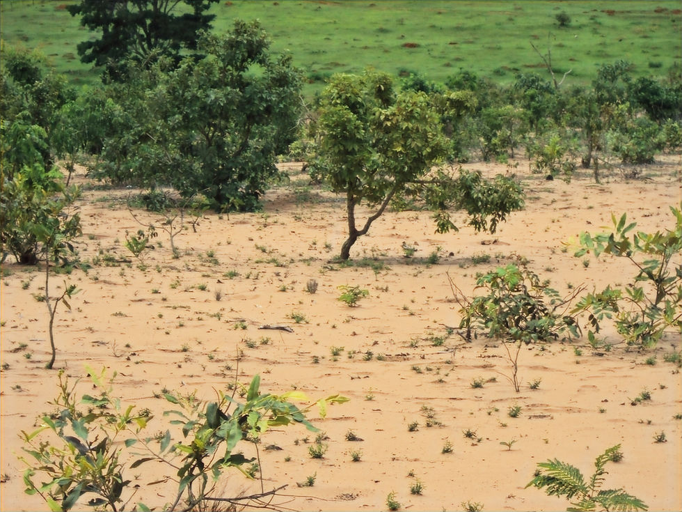
As a result of intense soil exploitation for agricultural and livestock farming, extensive patches of sand with little or no vegetation cover have emerged. It is a landscape similar to desertification. During my doctorate, in 2016, I identified hydrophobicity in the soils near these degraded areas, in the municipalities of Jataí and Serranópolis.
Soil hydrophobicity is when it repels water. This is a common phenomenon in areas of desertification or deserts, but in the degraded areas I study, it was completely unknown. We still do not know what causes hydrophobicity in these soils. It is important to remember that hydrophobicity in soils can be caused by the formation of a waxy layer related to organic matter, fungi, bacteria, soil texture, intense heat, or periods of drought. Identifying the hydrophobicity of the soils made us look in another direction, and we saw the possibility that these degraded lands were undergoing a process of desertification.
The issue of desertification had not been previously studied in these degraded areas, as this Brazilian region has a tropical climate with high rainfall. According to the United Nations, desertification is a phenomenon that occurs in arid, semi-arid, and dry sub-humid areas. Therefore, studies conducted in this region had previously treated the phenomenon as land degradation.
How can we explain desertification in areas where annual rainfall can exceed 2,000 millimetres?
Impossible, considering the current concept of desertification. In 2017, I analysed climate data and noticed variations in rainfall patterns over forty years. Prolonged periods of drought followed by heavy rainy seasons. This can slowly leach the most fertile soil layers, hinder plant growth, and contribute to erosion. I suspect that this, in humid areas, contributes to the onset of land degradation and, if left unrestored, it can progress to desertification.
However, to confirm this, further studies are needed, including those addressing geological factors and climate change. To better understand the dynamics of desertification and find similarities with the degraded lands I study in Brazil, after my doctorate, I began reviewing studies on desertification or deserts in Chile, Bolivia, Namibia, Angola, and Australia. The degraded area I study is located at or near the same latitude as the desertifications or deserts in these countries.
It is important to note that, at these latitudes, in the Brazilian states of Goiás and Mato Grosso do Sul, there are important natural reserves with ecosystems from the Cerrado and Pantanal biomes, above the Guarani aquifer. What little remains of the fauna and flora is disappearing. The Cerrado and the Pantanal are drying up, and so is the Guarani aquifer.

Call to action for the continuation and advancement of research on desertification in this region of Brazil
The scarcity of reliable data on land degradation and desertification hinders actions that could slow or reverse the loss of local biodiversity. There is an urgent need for more research and collective action to reverse environmental degradation.
Therefore, through partnerships and research funding, we call on researchers from different fields of science, research institutes, universities, policymakers and civil society to take action that can help to:
Restore degraded land to mitigate the desertification process and preserve biodiversity
Support research on hydrophobicity, as it is necessary to determine whether water repellency in soils is related to local erosion and desertification processes
Monitor the advance of degraded lands with the help of satellite data
Produce and monitor climate data using satellites, as many municipalities in this region do not have weather stations
Monitor of ground surface temperature with the help of satellites equipped with thermal sensors
Include these degraded lands as susceptible to desertification. This will allow decisions to be made that will prevent the problem from worsening. It can also help to develop actions to mitigate and adapt to climate change, prevent droughts and conserve ecosystems
About the Author
Régia Estevam is a geographer, professor and researcher, focusing on studies on land degradation and desertification. She holds a bachelor's and master's degree from the Universidade Federal de Goiás and a PhD from Universidade Nova de Lisboa.

Comments